Desert conditions · Wind
California City wind: the forecast and the windy season
In the Mojave, wind is the part of the forecast to read first. It raises dust, flattens tents, pushes trailers across lanes and turns a good ride into a bad one. Here is the live wind forecast, ten years of gust records from the two nearest stations, why it blows so hard here, and what the numbers mean on the ground.
Reference sections last reviewed · 12 sources
Reading the latest NWS wind forecast…
When is it windiest in California City?
Spring into early summer is the windy season. At the Mojave airport, about ten miles west-southwest of town, the average wind in May between 2016 and 2025 was 15.6 mph, and 82% of May days saw a gust of 30 mph or more. In April, 45% of days gusted to 40 mph or more.1 Autumn is the calm counterweight: in October only 35% of days reached a 30 mph gust.1
California City sits between the two nearest airport stations, and they differ. Mojave, nearer the Tehachapi Pass, is windier than Edwards Air Force Base, about sixteen miles south-southeast, in every month of the year.1 Use Mojave as the rough and Edwards as the gentle end of what the town is likely to feel.
Days with a gust of 40 mph or more, % of days
scripts/wind_climatology.py; each month uses the years with at least 70% of its days on record.| Month | Mojave (KMHV) | Edwards AFB (KEDW) | ||||
|---|---|---|---|---|---|---|
| Avg mph | Gust 30+ | Gust 40+ | Avg mph | Gust 30+ | Gust 40+ | |
| January | 9.7 | 41% | 23% | 7.8 | 23% | 7% |
| February | 10.8 | 46% | 22% | 9.3 | 28% | 8% |
| March | 13.0 | 63% | 29% | 11.9 | 43% | 10% |
| April | 14.8 | 75% | 45% | 13.2 | 53% | 18% |
| May | 15.6 | 82% | 43% | 13.8 | 60% | 11% |
| June | 15.1 | 81% | 38% | 13.2 | 57% | 8% |
| July | 13.3 | 70% | 16% | 12.6 | 49% | 1% |
| August | 12.0 | 56% | 17% | 11.3 | 36% | 2% |
| September | 10.1 | 36% | 12% | 9.3 | 26% | 3% |
| October | 9.8 | 35% | 16% | 8.0 | 21% | 4% |
| November | 9.3 | 34% | 20% | 7.2 | 19% | 7% |
| December | 8.9 | 34% | 17% | 6.8 | 18% | 4% |
scripts/wind_climatology.py.The Western Regional Climate Center’s long-published averages for Edwards tell the same story from an earlier decade: the calmest months average about 8 mph and May and June about 13.7 to 13.8 mph, with a year-round average of 10.8 mph.2
| Jan | Feb | Mar | Apr | May | Jun | Jul | Aug | Sep | Oct | Nov | Dec | Year |
|---|---|---|---|---|---|---|---|---|---|---|---|---|
| 8.7 | 10.1 | 11.1 | 13.1 | 13.7 | 13.8 | 12.0 | 10.8 | 9.6 | 9.2 | 8.3 | 8.2 | 10.8 |
Winter is calmer on average but not gentle: at Mojave, 8% of January days still gusted to 50 mph or more, four times July’s 2%.1
Why is it so windy here?
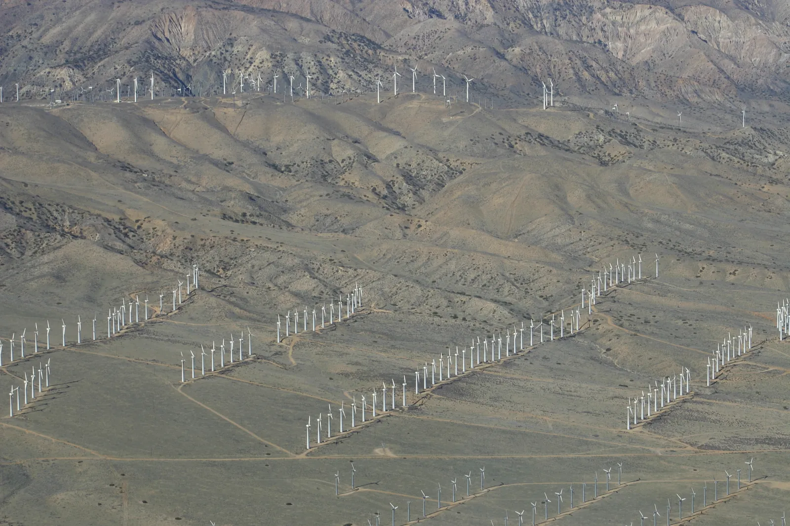
The U.S. Geological Survey’s account of the region’s wind is short: most of its wind turbines are grouped around the Tehachapi Pass, west of Mojave, where air flowing in from the Pacific Ocean funnels through the Tehachapi Mountains. In the part of the pass its Landsat images cover there were 3,250 turbines as of May 2023, rated at 2,905 megawatts.4 The Mojave airport, nearer the pass, is windier than Edwards Air Force Base in every month of the year.1

Which way does the wind blow?
Almost always from the west. The Western Regional Climate Center puts the prevailing wind at Edwards as southwest in every month except November, when it is west.3 The strong winds at Mojave, those of 20 mph or more, come most often from the west, and from the northwest from June to August.1 In practice that means dust from any open ground to the west of you, and a crosswind on any road that runs north–south.
Wind Advisory or High Wind Warning: what do the alerts mean?
The National Weather Service office in Hanford issues the alerts for California City5, and each office can set its own criteria.6 The national typical values:
- Wind Advisory: sustained winds of 30 to 39 mph for an hour or longer.6 The NWS’s advice is to secure objects outdoors and take care if driving.7
- High Wind Warning: sustained winds of 40 mph or more for an hour or longer, or gusts of 58 mph or more for any length of time.6 The advice is to seek shelter, and on the road to keep both hands on the wheel and slow down.7
- High Wind Watch: conditions are favourable for winds that meet the warning criteria in the next 12 to 48 hours.6 Secure loose things and adjust plans so as not to be caught outside.7
Any of these makes this guide’s riding and camping rating at least marginal, and a warning makes it poor; the weekend outlook explains the rest of the ratings.
What do wind speeds feel like on the ground?
The Beaufort scale, drawn up in 1805, is still the most useful plain-language guide to what a wind speed feels like.8 Note where dust starts: at a moderate breeze, well below anything the forecast will call windy.
| Wind | mph | What it does on land |
|---|---|---|
| Moderate breeze (force 4) | 13–18 | Dust, leaves and loose paper lifted; small tree branches move. |
| Fresh breeze (force 5) | 20–24 | Small trees in leaf begin to sway. |
| Strong breeze (force 6) | 25–31 | Larger tree branches moving; whistling in wires. |
| Near gale (force 7) | 32–38 | Whole trees moving; resistance felt walking against the wind. |
| Gale (force 8) | 39–46 | Twigs breaking off trees; generally impedes progress. |
| Strong gale (force 9) | 47–54 | Slight structural damage occurs. |
Riding
Dust is the first cost of wind on a bike or in a side-by-side, and it arrives early. The National Weather Service’s blowing-dust advisories and warnings usually require winds of 25 mph or more.6 This guide rates riding as marginal from 20 mph sustained or 30 mph gusts, and poor from 30 mph sustained or 45 mph gusts; the ratings on the forecast page explain why. A tall trailer or toy hauler on Highway 14 feels every gust, so read the wind alerts before towing.
Camping
Wind that is tolerable at midday often keeps going after dark, which is why this site’s camping rating counts the night after the day. Pitch with the narrow end of the tent into the west, use every guy line, and put the vehicle on the windward side. On a day with a Wind Advisory the NWS’s own advice is that objects outdoors should be secured, which includes the awning.7
Flying
California City Municipal Airport has a single runway, 06/24,9 which lines up broadly with the prevailing west and southwest winds.3 This page is not an aviation source, and the NWS lists no reporting station at the airport10; pilots should use the Mojave and Edwards reports and a proper briefing from the Aviation Weather Center.11
Blowing dust: when does visibility drop?
The NWS has two kinds of dust alert. For widespread blowing dust it issues a Blowing Dust Advisory when visibility falls to a mile or less, and a Blowing Dust Warning at a quarter of a mile or less; for short, sudden dust storms, usually off thunderstorm outflow, it issues Dust Advisories and Dust Storm Warnings on the same visibility thresholds.6
The NWS’s own public explainer describes the Dust Storm Warning differently, as half a mile of visibility or less with winds of 30 mph or more.7 The directive is the formal specification, so this page follows it, but either way the point is the same: when a dust alert is out, visibility on open ground can fall to a quarter of a mile or less.
How to read the wind forecast above
The wind forecast at the top of this page comes from the National Weather Service forecast grid for California City and is read fresh on every visit.12 It shows the strongest sustained wind and the highest gust forecast in each half-day. The NWS gives sustained wind and gusts separately; on a forecast of “15 mph, gusts to 30”, the gusts are what you will notice.
Sources
Every date, figure and name above traces to one of these. If something here is wrong or out of date, tell us and it will be fixed.
- 1.Integrated Surface Database (Global Hourly). NOAA National Centers for Environmental Information.Hourly wind and gust reports from Mojave (KMHV, 72295303183) and Edwards AFB (KEDW, 72381023114), 2016–2025, summarised by this site's scripts/wind_climatology.py.
- 2.Average Wind Speeds – MPH. Western Regional Climate Center (NOAA Regional Climate Center), data 1996–2006.
- 3.Prevailing Wind Direction. Western Regional Climate Center (NOAA Regional Climate Center), data 1992–2002.
- 4.Winds in the Antelope Valley. U.S. Geological Survey, Earth Resources Observation and Science Center (Earthshots).Air from the Pacific funnels through the Tehachapi Mountains; 3,250 turbines rated at 2,905 megawatts in the Landsat view as of May 2023.
- 5.Point metadata for 35.1258, -117.9858. National Weather Service.Assigns the city to the NWS Hanford office, the Mojave Desert forecast zone (CAZ339) and the Kern County Desert fire weather zone (CAZ299), and names the Edwards AFB radar (KEYX) as its radar.
- 6.NWSI 10-515: WFO Non-Precipitation Weather Products Specification. National Weather Service, 16 May 2025.The criteria behind Wind Advisories, High Wind Warnings, blowing-dust products and Freeze Warnings.
- 7.Wind Warnings, Watches and Advisories. National Weather Service.Plain-language guidance for each wind product. Its Dust Storm Warning criteria differ from NWSI 10-515's.
- 8.Beaufort Wind Scale. NOAA Storm Prediction Center.Speeds given in knots; converted to mph on this site.
- 9.California City Municipal Airport. Wikipedia.Runway 06/24, 6,027 by 60 feet.
- 10.Observation stations for the California City forecast point. National Weather Service.The NWS's list of reporting stations nearest the city, led by Mojave (KMHV) and Edwards AFB (KEDW).
- 11.Aviation Weather Center. NOAA National Weather Service.
- 12.API Web Service. National Weather Service.The live forecast, alerts and observations on these pages come from this free public API.