Desert conditions · Forecast
California City, CA weather
A general forecast tells you whether to take a jacket. In the desert the questions are different: how hard will it blow, will the dust get up, how hot is too hot, and can you have a fire. This page reads the National Weather Service's seven-day forecast for those desert conditions, and says plainly whether this weekend looks good for riding and camping.
Reference sections last reviewed · 15 sources
Reading the latest National Weather Service forecast…
How the riding and camping ratings work
Each day is rated twice. Riding covers daylight hours, 7am to 7pm, when people are out on bikes, quads and side-by-sides or driving the dirt grid. Camping covers the day and the night after it, because a tent that is fine at noon can be flattened at 2am. A rating is the worst of the things below, and every rating that is not “good” lists its reasons.
- Wind. Marginal from 20 mph sustained or gusts of 30 mph; poor from 30 mph sustained, which is where the National Weather Service’s Wind Advisory range begins, or gusts of 45 mph.1 Sustained winds of 40 mph or gusts of 58 mph are the NWS’s typical High Wind Warning criteria, and are called out as such.12 The gust thresholds are this guide’s own; the NWS sets gust criteria office by office.
- Dust. Flagged when the forecast calls for blowing dust or sand, or when sustained wind reaches 25 mph, the speed the NWS says its blowing-dust advisories and warnings usually require.1
- Heat. Uses the NWS’s own HeatRisk scale, which runs from 0 (little to none) to 4 (extreme): marginal at 2, “moderate”, and poor at 3, “major”, which the NWS describes as affecting anyone without cooling or hydration.3 A forecast high of 100°F or more is flagged whatever the HeatRisk.
- Cold. A forecast low of 32°F or below, the NWS freeze threshold, marks camping as marginal.1
- Rain and storms. Marginal from a 30% chance of rain, poor from 70%; a 20% chance of thunder is flagged because desert storms put water in washes fast.
- Alerts. Any NWS watch, warning or advisory covering the city overrides the forecast numbers. Warnings such as a High Wind Warning or Extreme Heat Warning make the day poor; advisories and watches make it at least marginal. A Red Flag Warning or Fire Weather Watch is always flagged4, because while either is in effect campfires and all target shooting are suspended on BLM land in the warned area.5
These are this guide’s reading of the forecast, not an official rating, and they cannot see what the forecast cannot: a gust front off a thunderstorm, or a canyon that funnels wind the valley floor never feels. Where the NWS has issued an alert, its wording beats anything on this page.
What is the weather like in California City?
Hot, dry summers, mild days and cold nights in winter, very little rain, and a windy spring. At Mojave, the nearest station with NOAA climate normals, the average high peaks at 97°F in July and August, and the average low bottoms out at 32°F in December.6 A normal year brings about 34 days of 100°F or more, about 40 nights at or below freezing and 5.76 inches of precipitation.7 The windiest months at the Mojave airport between 2016 and 2025 were April to June.8
California City’s weather year round has the averages month by month, with the records, and the best time to visit turns them into a verdict for each month.
What decides a desert weekend: wind, dust, fire and heat
Wind, most of the time. Spring is the windy season. At the Mojave airport, ten miles west, 45% of April days between 2016 and 2025 saw a gust of 40 mph or more, against 16% of October days.8 The California City wind forecast page has the whole year and what different speeds mean on a bike, in a tent and in the air.
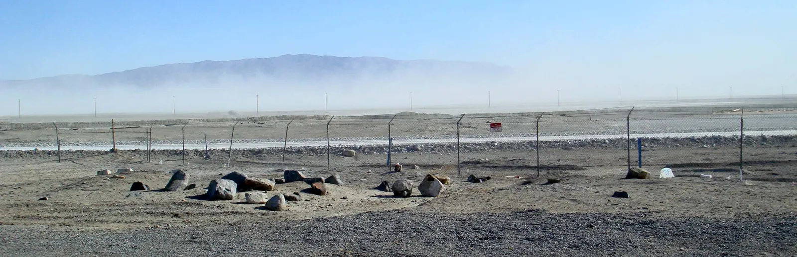
Dust comes with it. The National Weather Service’s blowing-dust advisories and warnings usually need winds of 25 mph or more1, and on open ground a strong wind can lift a wall of it.

Fire restrictions, from spring to autumn. The BLM’s 2026 seasonal order for the California Desert District runs from 15 April 2026 to 29 October 2026 unless lifted sooner, and the public land around California City falls in its Stage I area, where campfires are allowed only in the fire pits and grills of developed recreation sites.9 Fire restrictions around California City and Jawbone Canyon explains each level and who sets it.
Heat, in summer. The HeatRisk scale above is the honest measure; a 97°F afternoon on an exposed trail is a different thing from 97°F in town.
And the season. The climate month by month has a normal year, and the best time to visit California City what each month means for a trip.
Where does this forecast come from?
California City is forecast by the National Weather Service office in Hanford, as part of its Mojave Desert forecast zone (CAZ339) and its Kern County Desert fire weather zone (CAZ299).10 The live blocks on these pages are read from the NWS’s free public API when the page loads, held for at most five minutes, and never frozen into the page.11 The NWS’s own seven-day forecast for California City carries the same forecast in its own words.12
The current conditions come from the two nearest airport weather stations, at Mojave and at Edwards Air Force Base, because the NWS lists no reporting station in the city itself.13
For hour-by-hour detail, the NWS’s hourly forecast graph for California City plots temperature, wind, gusts and the chance of rain for the week ahead.14 The nearest weather radar is at Edwards Air Force Base (KEYX), the station the NWS assigns to the city10, and its live radar loop is the place to watch a storm coming in.15
Sources
Every date, figure and name above traces to one of these. If something here is wrong or out of date, tell us and it will be fixed.
- 1.NWSI 10-515: WFO Non-Precipitation Weather Products Specification. National Weather Service, 16 May 2025.The criteria behind Wind Advisories, High Wind Warnings, blowing-dust products and Freeze Warnings.
- 2.Wind Warnings, Watches and Advisories. National Weather Service.Plain-language guidance for each wind product. Its Dust Storm Warning criteria differ from NWSI 10-515's.
- 3.NWS HeatRisk. National Weather Service.The five HeatRisk categories and who each one affects.
- 4.Fire Weather Watches and Red Flag Warnings. National Weather Service.
- 5.Fire Prevention Order CAD-000-2026-01: California Desert District Year-round Fire Restrictions. Bureau of Land Management, 2026.
- 6.U.S. Climate Normals 1991–2020, monthly: Mojave, CA (USC00045756). NOAA National Centers for Environmental Information.Average highs and lows, precipitation, snowfall and freezing nights by month.
- 7.U.S. Climate Normals 1991–2020, annual and seasonal: Mojave, CA (USC00045756). NOAA National Centers for Environmental Information.Days of 90°F and 100°F or more, and freezing nights, per year and per season.
- 8.Integrated Surface Database (Global Hourly). NOAA National Centers for Environmental Information.Hourly wind and gust reports from Mojave (KMHV, 72295303183) and Edwards AFB (KEDW, 72381023114), 2016–2025, summarised by this site's scripts/wind_climatology.py.
- 9.Fire Prevention Order CAD-000-2026-02: California Desert District Seasonal Fire Restrictions. Bureau of Land Management, April 2026.
- 10.Point metadata for 35.1258, -117.9858. National Weather Service.Assigns the city to the NWS Hanford office, the Mojave Desert forecast zone (CAZ339) and the Kern County Desert fire weather zone (CAZ299), and names the Edwards AFB radar (KEYX) as its radar.
- 11.API Web Service. National Weather Service.The live forecast, alerts and observations on these pages come from this free public API.
- 12.7-Day Forecast for California City. National Weather Service.The same forecast in the NWS's own words, with the hazards it is carrying.
- 13.Observation stations for the California City forecast point. National Weather Service.The NWS's list of reporting stations nearest the city, led by Mojave (KMHV) and Edwards AFB (KEDW).
- 14.Hourly Weather Forecast Graph for California City. National Weather Service.Temperature, wind, gusts, sky cover and chance of rain hour by hour for the next week.
- 15.Radar: KEYX, Edwards AFB. National Weather Service.