Facts · Reference
California City, CA: population and quick facts
The quick answers: how many people live here, which county it is in, the ZIP code, how far it is from Los Angeles, and the questions people most often ask about the place. Every figure links to where it comes from.
Figures checked · next state population estimate due May 2027 · 26 sources
Where is California City, and what is its ZIP code?
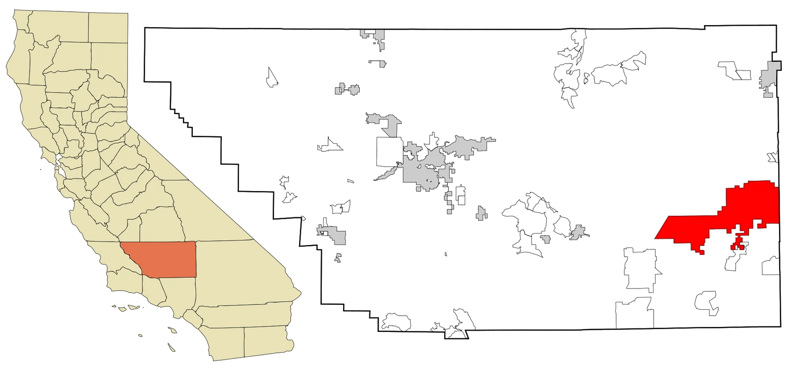
In the western Mojave Desert, on the eastern side of Kern County,14 with the ZIP code 93505.6 The rest of the essentials are below, each with its source.

- Population, 2020 census
- 14,9731The official count on 1 April 2020.
- Population now
- 13,1412California Department of Finance estimate for 1 January 2026, 0.8% lower than a year earlier. Next estimate due May 2027.
- Homes
- 5,4293Housing units on 1 January 2026, 4,795 of them occupied.
- Area
- 203.7 square miles54203.6 of it land: the third-largest land area of any city in California, after Los Angeles and San Diego.
- Time zone
- Pacific4UTC−8, and UTC−7 in daylight saving time.
- Elevation
- 2,405 feet9733 metres, at the town's mapped point.
- Coordinates
- 35.1258° N, 117.9859° W95The town. The centre of the city limits, out in the empty grid, is 35.1466° N, 117.8693° W.
- Founded
- 19584When developers bought the land and began marketing it as a city.
By road from City Hall
- Edwards Air Force Base, north gate
- 13.5 miles10About 21 min with no traffic.
- Mojave
- 15.7 miles10About 23 min with no traffic.
- Lancaster
- 41.8 miles10About 54 min with no traffic.
- Bakersfield
- 70.2 miles10About 1 h 27 min with no traffic.
- Downtown Los Angeles
- 110.0 miles10About 2 h 11 min with no traffic.
Every other destination, with drive times, is in getting here.
What is the population of California City?
The census has counted California City every ten years since it incorporated in 1965.1 Since 2020 the state’s estimates also split each year’s total into people living in homes and people in group quarters,3 which is where the prison’s inmates were counted until the state moved the last of them out in November 2023.17
- 19701,309
- 19802,743
- 19905,955
- 20008,385
- 201014,120
- 202014,973
| Date | Total | In homes | Group quarters |
|---|---|---|---|
| 15,018 | 12,909 | 2,109 | |
| 14,983 | 12,924 | 2,059 | |
| 14,998 | 12,800 | 2,198 | |
| 14,776 | 12,911 | 1,865 | |
| 13,109 | 13,065 | 44 | |
| 13,243 | 13,199 | 44 | |
| 13,141 | 13,097 | 44 |
Questions people ask about California City
Is California City a ghost town?
Is California City growing?
Not in its headline figure. The Department of Finance’s estimate fell from 14,776 in January 2023 to 13,109 a year later, but the fall was in group quarters, people living in institutions, which went from 1,865 to 443 as the state moved the last inmates out of the prison on the edge of town in November 2023.17 The number of people living in homes has edged up, from 12,909 at the 2020 census benchmark to 13,097 in January 2026.3
Why is California City so empty?
Is California City safe?
By the state’s own figures, violent crime runs higher than the California average and property crime lower. In 2025 the California City Police Department reported 68 violent and 179 property crimes to the Justice Department:18 against the city’s population that is about 5.1 violent crimes per 1,000 residents, compared with 4.3 across the state, and 13.5 property crimes per 1,000, compared with 17.8.2 The Living section sets out every year since 2015, against Kern County as well, and what the rating sites’ grades are built on.
Why is California City so cheap?
Because there is far more land than anyone has wanted to build on. The city’s own parcel inventory, compiled in 2010, counted 36,007 vacant residential parcels covering 83 per cent of its land,14 and Nat Mendelsohn’s company alone had sold land there to more than 73,000 people.15 Houses are cheaper too: the Census Bureau’s survey for 2020–2024 puts the median value of an owner-occupied home at $278,000, against $734,700 across California.16
Land and lots →section in progress
Is my lot in California City worth anything?
It depends on the parcel, and there is no public price list. The Kern County Assessor’s property search gives the assessed value of any lot by its parcel number,19 and the clearest recent benchmark for raw land is the state’s Silver Saddle fraud case, where the court-appointed receiver’s sale of the 1,000 acres behind the Galileo Project’s 4,000 investor shares was approved at $900,000 in April 2022.2015 An assessed value is not a price; finding your parcel explains what the county’s record does and does not tell you. A guide to selling is still being written.
What county is California City in?
What is California City's ZIP code?
How far is California City from Los Angeles?
Can I ride OHV in California City?
Yes. The city describes more than 1,800 miles of combination-use roads and dirt trails and 33.5 miles of designated OHV trail, including a route into the business district.22 Off-highway vehicles must display a green sticker and a California City street operating permit,23 which the city’s OHV Department issues;24 outside town, BLM routes in desert tortoise critical habitat have been closed to recreational riding by court order since 24 March 2026.25
When is Desert Tortoise Days?
Desert Tortoise Days is the Chamber of Commerce’s annual spring festival; in 2026 it was held on 2 and 3 May, with a parade from City Hall to Central Park.26 Check the date with the Chamber before planning a trip around it.
Sources
Every figure above traces to one of these, checked on 22 September 2026. Population estimates are revised each May, and this page is refreshed when they are. If something here is wrong, tell us and it will be fixed.
- 1.Historical Census Populations of Counties and Incorporated Cities in California, 1850–2020. California Department of Finance, Demographic Research Unit, revised 13 August 2021.The decennial census count for every census since incorporation (1970 to 2020), the county, and the 1965 incorporation year.
- 2.E-1 Population Estimates for Cities, Counties, and the State, January 1, 2025 and 2026. California Department of Finance, May 2026.California City: 13,141 on 1 January 2026, against a revised 13,243 a year earlier. The state: 39,646,907 on 1 January 2025.
- 3.E-5 Population and Housing Estimates for Cities, Counties, and the State, 2020–2026. California Department of Finance, May 2026.Splits each year's estimate into people living in households and people in group quarters (institutions such as prisons), and counts housing units.
- 4.California City, California. Wikipedia.Used for the 1958 founding, the incorporation date of 10 December 1965, the 400,000-resident master plan, the city's rank by land area, the ZIP codes and the time zone.
- 5.2020 Census Gazetteer Files: Places, California. U.S. Census Bureau, 2020.California City: 203.611 square miles of land and 0.085 of water; internal point 35.14659, −117.869346.
- 6.2020 ZIP Code Tabulation Area to Place relationship file. U.S. Census Bureau, 2020.ZIP code area 93505 is the one that covers the town. There is no tabulation area for 93504.
- 7.Area code and prefix search: exchange 018990, California City. Local Calling Guide, from North American numbering data.The California City rate centre's prefixes are all in 760 or 442.
- 8.Area Codes and Numbering. California Public Utilities Commission.Lists 442 as an overlay of 760.
- 9.California City (populated place, feature 1660418). U.S. Geological Survey, Geographic Names Information System.Elevation 733 metres at 35.125801, −117.9859038.
- 10.OSRM routing on OpenStreetMap data, from California City City Hall. Project OSRM and OpenStreetMap contributors, routed 17 September 2026, long-distance rows added 24 September 2026.Every distance and time was computed this way, and each one links to its own route so it can be re-run. Times assume no traffic.
- 11.California City street network and city limits. OpenStreetMap contributors, extracted 2026-09-17.Queried through the Overpass API and committed to this repository. Licensed under the Open Database Licence.
- 12.GlobalMLBuildingFootprints. Microsoft.Building outlines detected from satellite imagery and released under the Open Database Licence. 5,883 of them fall inside the city limits.
- 13.Annual Estimates of the Resident Population for Incorporated Places (sub-est2024). U.S. Census Bureau, Population Estimates Program, 2024.California City: 14,971 at the 2020 estimates base, 13,174 estimated for 2024.
- 14.Housing Element Update 2015–2023, Table 5.3: Vacant Land Inventory by Residential Zoning District. City of California City Planning Department, data dated 2010.The city's own parcel inventory. Archived from this domain, which hosted the city's website until 2015.
- 15.60 years of deception and land sales in California City: 7 takeaways from my investigative podcast. Emily Guerin, LAist, 2 September 2020.
- 16.Median Value (Dollars), owner-occupied housing units (table B25077), American Community Survey 2020–2024 5-year estimates. U.S. Census Bureau.California City $278,000 (margin of error ±$18,789); Kern County $338,300 (±$2,944); California $734,700 (±$1,307).
- 17.California City Detention Facility. Wikipedia.The state moved the last inmates out of the prison in November 2023.
- 18.Crimes and Clearances (including Arson), 1985–2025. California Department of Justice, OpenJustice, 2026.Crimes reported by each law enforcement agency, by year. California City is the California City Police Department's row; Kern County is the sum of every agency in the county.
- 19.Assessor property search. Kern County Assessor-Recorder.
- 20.People v. Silver Saddle Commercial Development, LP, et al.: receivership docket and updates. Thomas W. McNamara, court-appointed receiver (Regulatory Resolutions).The receiver's dated record of the case, including the court-approved sale of the Galileo Project land.
- 21.Kern County, California. Wikipedia.Bakersfield as the county seat.
- 22.Designated OHV Areas. City of California City.
- 23.Vehicle Travel. Friends of Jawbone.
- 24.About Us (OHV Department: permits and Borax Bill Park). City of California City.Permits, Borax Bill Park's facilities and hookup charges, and the RV dump and water station policy and hours. Re-read 24 September 2026.
- 25.West Mojave Plan route network. Bureau of Land Management.BLM's notice of the court-ordered closure of routes in desert tortoise critical habitat to OHV recreation from 24 March 2026, the areas that remain open, and the Rand Mountains permit.
- 26.Desert Tortoise Days to be held May 2nd and 3rd. Desert News, 25 April 2026.