Nearby · Mining town · Kern County
Randsburg, California: a living ghost town
A gold-rush town of 1895 that never quite emptied. Randsburg had 45 residents at the 2020 census, a main street of century-old buildings, a museum and, by 2026, very few businesses still open. Go for the history, and bring what you need.
Last reviewed · 22 sources
At a glance
- What it is
- An unincorporated community and census-designated place in Kern County1
- Population
- 45 at the 2020 census2
- Where
- In the Rand Mountains, on the west side of US 395; elevation 3,504 feet1
- Landmark
- California Historical Landmark No. 938, the Rand Mining District3
- Fuel
- Friends of Jawbone says gas is available in neighbouring Johannesburg; we found no reliable source for fuel in Randsburg itself19
Is Randsburg a ghost town?
Randsburg is an unincorporated community in Kern County, formerly called Rand Camp, in the Rand Mountains on the west side of US 395. A ridge separates it from its neighbour, Johannesburg.1 At the 2020 census it had 45 residents and Johannesburg 113.2 SFGATE reported in 2026 that the population had fallen from 77 in 2000 and 69 in 2010, as the town lost most nearby mining, its school and its post office.4
A billboard on 395 sells it as a “living ghost town”.4 That is fair. People live here and the old buildings are standing, but this is not a staged attraction. The main street is Butte Avenue.4
1895: the Yellow Aster strike
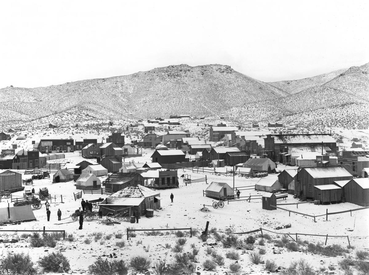
In April 1895 Singleton, Burcham and Mooers found the Yellow Aster, or Rand, mine. Randsburg grew up quickly around it, followed in 1896 by the supply town of Johannesburg; both names came from the mining district of South Africa, whose minerals the ground here was thought to resemble.3 The Rand Mining District was organised on 20 December 1895, and a post office opened in Randsburg in 1896.1
.jpg)
Growth was fast. Wikipedia, citing a 2022 railway history article, puts the population above 1,500 by the end of 1896;1 Western Mining History gives about 2,000 by January 1897 and more than 3,500 by 1899,6 the peak SFGATE also reports.4 Fire was a constant threat: Western Mining History records a fire on 19 January 1898 that destroyed half the town and another that May,6 and a local marker mentions a further fire in 1903.8
The Randsburg Railway, a 28.5-mile branch from the Santa Fe main line at Kramer Junction, reached Johannesburg rather than Randsburg itself and began running in January 1898; it closed on 30 December 1933.11 An E Clampus Vitus plaque credits the Yellow Aster with almost $25 million in gold between 1895 and about 1933, at prices of around $20 an ounce.7
Tungsten, silver and the open pit
Gold was not the only strike. The state landmark record dates the discovery of tungsten at Atolia, used in steel alloys during the First World War, to 1907, and the California Rand Silver Mine at Red Mountain to June 1919.3 Wikipedia’s article on Atolia places the first tungsten finds in 1904 and 1905.12 Atolia is just across the county line, in San Bernardino County.12
The Yellow Aster was mined again in the modern era, as an open pit. The California Geological Survey says Glamis Gold operated the Rand Mine from 1984 and stopped mining in January 2003;13 the Center for Land Use Interpretation dates the end of mining to 2004, and says environmental remediation was completed in 2012.14
What is there to see in Randsburg now?
.jpg)
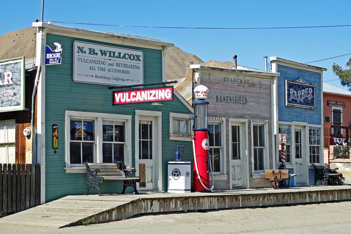
The state landmark, No. 938, is the Rand Mining District as a whole, not the town, and its registration is dated 15 January 1981. The state lists its location at the desert museum on Butte Avenue.3 The museum describes itself as a nonprofit preserving the history and architecture of the Rand Mining District;15 check its website for when it is open. Its site also covers the Rand District Cemetery, which is in Johannesburg.16
The old Randsburg city jail carries a plaque recalling the miners, cowboys and others who passed through it and the White House Saloon.7 The saloon building still stands on Butte Avenue, and SFGATE photographed it shuttered in April 2026.94 So did the general store, whose soda fountain dates from 1904; SFGATE reported it has been closed since 2022.84
How do you get to Randsburg?
Randsburg is reached from US 395, which runs past the town between Kramer Junction and Ridgecrest.1 A storm in September 2025 washed out Redrock–Randsburg Road, which was closed between Highway 14 and Garlock Road,5 and in May 2026 SFGATE reported that the only other road into town besides 395 was still closed indefinitely after the flood.4 We could not confirm whether it has since reopened. Check with Kern County before planning a route that uses it.
The old stage road between Mojave and Randsburg, opened in 1898, ran 36 miles; Kern County took it over as a county road in 1924.10 That is history, not today’s driving distance. By the highways, Highway 58 east to Kramer Junction and US 395 north, it is about 61 miles from California City’s City Hall, around an hour and a quarter.22 Other roads are on getting here.
Can you ride an OHV to Randsburg?
SFGATE’s reporting makes clear how much the town’s remaining businesses depend on off-highway riders.4 The public land between the town and California City is the BLM’s Rand Mountains Management Area,18 and since 24 March 2026 a federal court order has closed routes in desert tortoise critical habitat, which covers the management area, to recreational riding and driving, street-legal vehicles included.2120 The detail, and what BLM’s permit does and does not allow, is on the Rand Mountains Management Area page.
Are the old mines safe to explore?
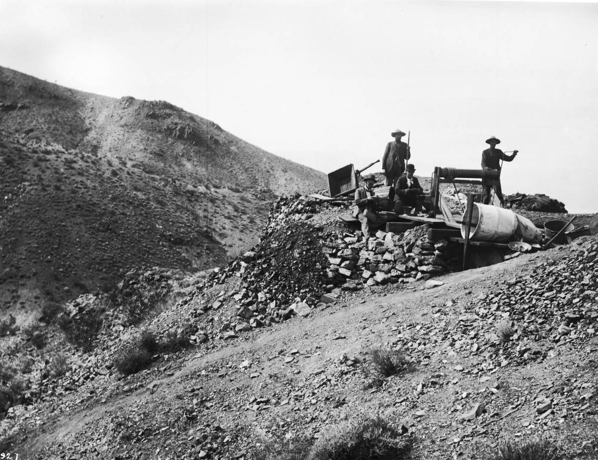
No. More than a century of mining has left high concentrations of arsenic in mine tailings and some desert washes around Randsburg. BLM says old mines should be observed from a safe distance, and that you should never enter or disturb them.20
.jpg)
When is Old West Days?
The Rand Desert Museum sponsors Old West Days each year. The 2026 event was on 19 September, from 10am to 4pm, with a parade, a car show and live music; when this page was checked on 24 September 2026 the museum had not yet listed a date for 2027.17 The 2025 event was cancelled by the September storm,5 and SFGATE reported that it was rescheduled to November, and that it is the town’s biggest event and an important fundraiser for the museum.4
Sources
Every fee, rule, distance and date above traces to one of these, checked on the review date. Rules, closures and fees change: where it matters, confirm with the managing agency before you go. If something here is wrong, tell us and it will be fixed.
- 1.Randsburg, California. Wikipedia.
- 2.2020 Census, Table C1: Kern County summary (redistricting file). California Department of Finance, via Kern Council of Governments, August 2021.
- 3.Rand Mining District (California Historical Landmark No. 938). California Office of Historic Preservation.
- 4.'This town is done': California tourist destination loses its last lifeline. Tessa McLean, SFGATE, 28 May 2026.Dated reporting on the town's businesses, the flood-damaged road and the effect of the 2026 trail closures.
- 5.Storm wreaks havoc in Randsburg, forcing festival cancellation. KBAK/KBFX Bakersfield Now, 19 September 2025.
- 6.Randsburg California. Western Mining History.Undated; used only for figures attributed to it.
- 7.Randsburg, California Historical Marker (E Clampus Vitus plaque No. 57). The Historical Marker Database.
- 8.Randsburg Drug Store Historical Marker. The Historical Marker Database.
- 9.White House Saloon Historical Marker. The Historical Marker Database.
- 10.The Randsburg - Mojave Road Historical Marker. The Historical Marker Database.
- 11.Randsburg Railway. Wikipedia.
- 12.Atolia, California. Wikipedia.
- 13.California Non-Fuel Minerals 2004. California Geological Survey.
- 14.Rand Mine. The Center for Land Use Interpretation.
- 15.Rand Desert Museum. Rand Desert Museum.
- 16.Rand District Cemetery. Rand Desert Museum.
- 17.Events. Rand Desert Museum.Checked 24 September 2026: lists the 2026 Old West Days and no later date.
- 18.Rand Mountains–Fremont Valley Management Plan: notice of final approval, availability and implementation. Federal Register, vol. 59, no. 115, 16 June 1994.
- 19.Rand Mining District. Friends of Jawbone.
- 20.Rand Mountains Management Area permit and map. Bureau of Land Management, 23 March 2026.The free permit itself, with the area's rules, history, tortoise information and the 2026 closure notice.
- 21.West Mojave Plan route network. Bureau of Land Management.BLM's notice of the court-ordered closure of routes in desert tortoise critical habitat to OHV recreation from 24 March 2026, the areas that remain open, and the Rand Mountains permit.
- 22.Route from California City City Hall to Randsburg by Highway 58 and US 395. OSRM routing on OpenStreetMap data, routed 17 September 2026.61.1 miles; about 77 minutes in free-flowing traffic, routed through Kramer Junction to avoid the flood-damaged county roads.