Nearby · BLM land · Desert tortoise habitat
The Rand Mountains Management Area
The mountains between California City and Randsburg: old mining country, and designated critical habitat for the desert tortoise. Since March 2026 a federal court order has closed routes in that habitat to recreational driving and riding.
Last reviewed · 14 sources
At a glance
- Where
- Northeast of California City and southwest of Randsburg9
- Managed by
- Bureau of Land Management, as the Rand Mountains Management Area1
- Riding in 2026
- Routes in desert tortoise critical habitat closed to OHV recreation, street-legal vehicles included, until further notice; BLM says the area is critical habitat1
- Permit
- BLM still requires a free, signed permit for OHV recreation in the area3
- Camping
- Designated areas only1
- Ask first
- BLM Ridgecrest Field Office, (760) 384-54008
Where are the Rand Mountains?
The Rand Mountains rise northeast of California City and southwest of the old mining town of Randsburg. The highest points are Government Peak, at 4,741 feet, and Sidney Peak, at 4,372 feet.9 Gold was found near Randsburg in 1895; the area BLM manages here takes in part of the historic Atolia and Rand mining districts, and silver and tungsten were mined too.1 The town is covered in Randsburg.
BLM says the Rand Mountains Management Area has drawn off-highway riders, rockhounds and environmentalists since the 1960s, and that after the desert tortoise was listed under federal law it developed the Rand Mountains Fremont Valley Management Plan.1 The management area and much of the land around it is designated critical habitat for the tortoise.1
As the 1994 plan drew it, the management area runs from Randsburg and US 395 on the east to the western edge of Koehn Dry Lake and the Desert Tortoise Natural Area on the west, and from the Garlock and Randsburg–Red Rock roads on the north down to the city limits of California City on the south. The same plan designated 44,800 acres of it as category 1 desert tortoise habitat.2
Are the Rand Mountains OHV routes open in 2026?
A federal court found that BLM’s 2019 route network plan for the western Mojave did not comply with the law. Under its order of 23 January 2026, all routes in desert tortoise critical habitat are closed to off-highway recreation, including street-legal vehicles, until further notice.1 BLM has applied the closures since 24 March 2026.3 Friends of Jawbone lists the Rand Mountains among the route closures in its region.6 The federal government has appealed.5
At the same time BLM says a free permit is required for OHV recreation in the Rand Mountains Management Area.3 The same court order directed BLM to reinstate the Rand Mountains permit system that existed before 2019, with required education and free but mandatory permits.4 The permit is BLM’s area map: you sign a certification on it, carry it while riding, and agree to use only posted, designated open routes.1 The programme behind it dates from the 2005 West Mojave plan, which directed BLM to educate riders in the management area about its route network, safety and habitat. BLM publishes the map as a download, and lists its Ridgecrest Field Office and the Jawbone Station visitor center, (760) 373-1146, for information.1
Designated county roads and highways, and routes needed for easements, administrative and emergency access and other permitted uses, stay open, but not for public OHV recreation.3 California City’s own designated trails, CC5 and CC10, were laid out from a connection with BLM trail R5 at Bucknell and Chrysler Drive, and the city’s page describing them does not mention the 2026 closures.14 Ask BLM whether a connecting route is open before riding out of town on it.
What are the rules in the management area?
Whatever the status of individual routes, the management area’s rules still apply.1
- Designated routes only. This is a limited-use area where routes are closed unless signed open. Legal routes are marked with brown numbered posts, and it is illegal to ride anywhere else. A violation of the federal rule carries a fine of up to $1,000, up to 12 months in jail, or both.1
- Camping only in designated areas; pack out what you bring.1
- Target shooting is prohibited. Firearms may not be discharged at any time, except shotguns in the upland and mountain portions of the area.1
- Noise is limited to 96 dBA for vehicles built from 1986 and 101 dBA for older ones.1
- No open containers of alcohol while operating a vehicle on BLM land in California.1
- Lights: a headlight and at least one red tail light to ride at night.1
Mines, arsenic and signal
More than a century of mining around Randsburg has left high concentrations of arsenic in mine tailings and some desert washes. BLM says the best way to avoid exposure, and the old mines themselves, is to stay on the posted routes, and never to enter or disturb mine workings.1
Cell coverage is limited in places. In an emergency call 911 where you can; GPS coordinates help responders find you. BLM’s ranger dispatch, for emergencies only, is (909) 383-5652.1
Why the tortoise decides everything here
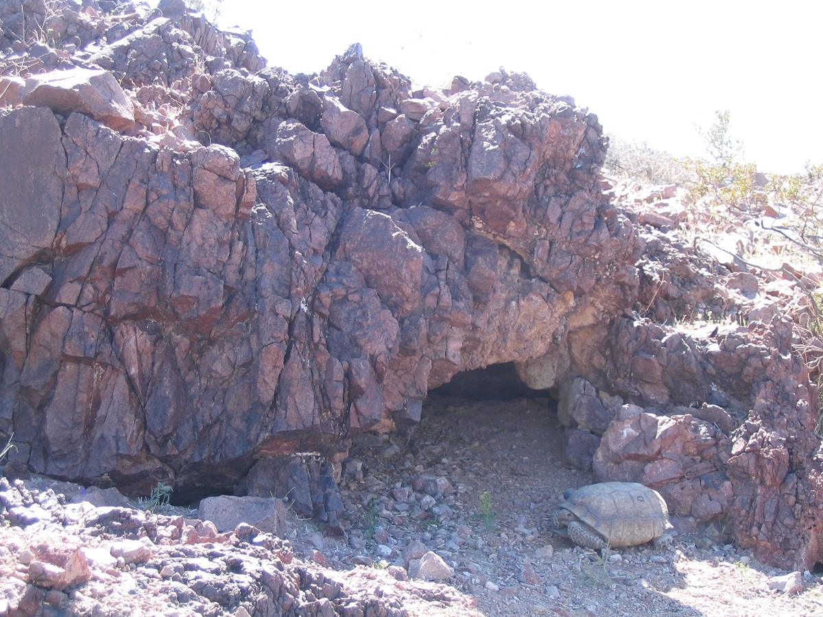
The desert tortoise has been listed as threatened under the federal Endangered Species Act since 1990. BLM says that as recently as the 1970s tortoise densities in the Fremont Valley reached 250 per square mile, and that the figure has since fallen below 20.1 In June 2025 California moved it from threatened to endangered under state law.10
It is California’s official state reptile. BLM’s brochure says the species has existed in its current form for 18 million years, and that tortoises have been observed to live to 80 and beyond in the wild.1
_(6012501260).jpg)
Tortoises are most active in late winter and spring but stay active from March through September; in summer, mostly in the mornings and evenings. The management area is also home to Mohave ground squirrels, LeConte’s thrashers, burrowing owls, golden eagles, prairie falcons and several sensitive species of bat.1
The Desert Tortoise Research Natural Area
Next to the management area, on the western edge of the Rand Mountains, is the Desert Tortoise Research Natural Area: 39.5 square miles of habitat set aside for the local wild population of desert tortoise, with trails that visitors can walk.11 The nonprofit Desert Tortoise Preserve Committee helps manage it under a cooperative agreement with BLM’s Ridgecrest office.10 Motorized travel inside it is prohibited.1
- Where. The interpretive center is about four miles northeast of California City, just off the unpaved Randsburg-Mojave Road; the committee’s directions follow that dirt road for about four miles.11 It also gives it as about three miles northwest of Borax Bill Park.12
- What is there. A parking area and a kiosk with descriptive panels, shelter and benches, dedicated in April 1980,11 three self-guiding walking trails and a restroom.12
- Cost. Free; donations welcome. The committee lists it as open every day from 8am to 5pm.11
- When. Mid-March to mid-June, when temperatures are milder and a committee naturalist is on site.11
- Rules. No pets inside the fence, no OHVs, and it is illegal to release captive tortoises or move wild ones. Bring a hat, water, sunscreen and closed-toe shoes, watch for Mojave rattlesnakes, and check under your car and in front of the tyres before you leave.1312
Sources
Every fee, rule, distance and date above traces to one of these, checked on the review date. Rules, closures and fees change: where it matters, confirm with the managing agency before you go. If something here is wrong, tell us and it will be fixed.
- 1.Rand Mountains Management Area permit and map. Bureau of Land Management, 23 March 2026.The free permit itself, with the area's rules, history, tortoise information and the 2026 closure notice.
- 2.Rand Mountains–Fremont Valley Management Plan: notice of final approval, availability and implementation. Federal Register, vol. 59, no. 115, 16 June 1994.
- 3.West Mojave Plan route network. Bureau of Land Management.BLM's notice of the court-ordered closure of routes in desert tortoise critical habitat to OHV recreation from 24 March 2026, the areas that remain open, and the Rand Mountains permit.
- 4.Center for Biological Diversity et al. v. Culver et al., No. 21-cv-07171-SI: remedy order. U.S. District Court, Northern District of California (via BLM), 23 January 2026.
- 5.BRC files intervention in Ninth Circuit appeal of WEMO closures. BlueRibbon Coalition (an off-highway access advocacy group), 6 May 2026.Reports the federal government's notice of appeal. An advocacy source, used only for the fact of the appeal.
- 6.Federal Court Orders OHV Route Closures in Mojave Desert. Friends of Jawbone, 4 February 2026.
- 7.Rand Mountain Management Area. Friends of Jawbone.
- 8.Ridgecrest Field Office. Bureau of Land Management.The office's address and phone, the areas it manages, and the Jawbone Canyon visitor center's address, hours and phone.
- 9.Rand Mountains. Wikipedia.
- 10.News & Press. Desert Tortoise Preserve Committee.
- 11.Overview & Location: Desert Tortoise Research Natural Area. Desert Tortoise Preserve Committee.
- 12.Off Highway Vehicle Info. Desert Tortoise Preserve Committee.
- 13.Visiting the DTRNA. Desert Tortoise Preserve Committee.
- 14.Designated OHV Areas. City of California City.