Nearby · BLM land · Wilderness
The El Paso Mountains, California
The badlands range behind Red Rock Canyon, north of California City: volcanic mesas, red buttes, a federal wilderness where nothing with wheels may go, and the tunnel one prospector spent decades digging through a mountain.
Last reviewed · 17 sources
At a glance
- Where
- East of Highway 14, north of the Rand Mountains; about 16 miles north-northeast of California City4
- Wilderness
- El Paso Mountains Wilderness, 23,780 acres, designated 31 October 19942
- Managed by
- Bureau of Land Management, Ridgecrest Field Office7
- Highest point
- Black Mountain, 5,244 feet1
- In the wilderness
- No motor vehicles, bicycles or other mechanical transport1
- Water
- Carry at least a gallon per person per day16
Where are the El Paso Mountains?
.jpg)
The El Paso Mountains run southwest to northeast for about 18 miles, east of Highway 14 and north of the Rand Mountains and Randsburg Red Rock Road. Red Rock Canyon State Park sits at the western end of the range, and Highway 395 crosses it near Johannesburg.4
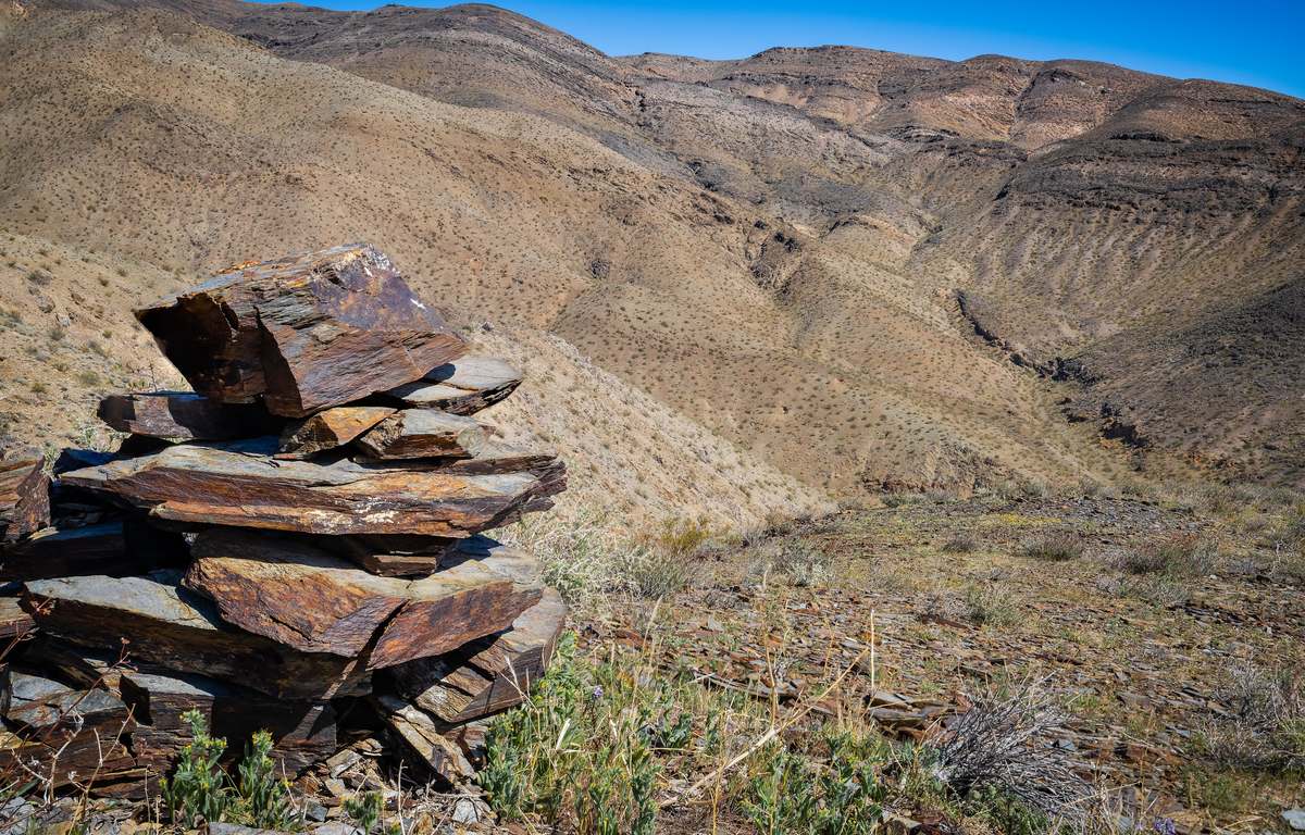
BLM describes the landscape as badlands: from Black Mountain, at 5,244 feet the highest point, the ground falls into the Black Hills and breaks into dark volcanic mesas and reddish buttes cut by narrow canyons. Creosote covers most of it, and Joshua trees grow on the western side of Black Mountain. Some of the oldest non-marine fossils found in the West, of early camel-like and horse-like animals, were discovered here, and visitors may see desert tortoises, Mohave ground squirrels and raptors.1
Can you drive in the El Paso Mountains Wilderness?
Congress designated the El Paso Mountains Wilderness in the California Desert Protection Act of 1994, on about 23,780 acres of BLM land.32 The same act transferred about 20,500 acres of federal land to Red Rock Canyon State Park next door.3 BLM’s Ridgecrest Field Office manages the wilderness.7
BLM’s 2026 closure of routes in desert tortoise critical habitat applies across the western Mojave.9 Friends of Jawbone’s list of closures in its region does not name the El Paso Mountains,10 but check BLM’s closure map for the specific route before you drive it.9
Last Chance Canyon
Last Chance Canyon runs from Saltdale in the south to Black Mountain in the north, and part of it is inside Red Rock Canyon State Park. It holds archaeological sites including pictographs, village sites and rock shelters, and was added to the National Register of Historic Places on 5 December 1972.5 The southern part of the wilderness is in the Last Chance Archaeological District.2 Geologically it is the best place to see the Goler Formation, rocks more than 3,000 feet thick and 55 to 65 million years old.6
BLM asks wilderness visitors to follow the Leave No Trace principles, among them leaving what you find.1 The part of the canyon inside the state park, which has its own rules, is covered in hiking at Red Rock Canyon.
Burro Schmidt's Tunnel: its history and how to get there
William Henry “Burro” Schmidt was a prospector with claims in the El Paso Mountains who dug a tunnel through the inside of a mountain by hand, with some explosives. He broke through to daylight on the far side in 1938, found no gold, and died in January 1954.1112 How long it is depends on the source: Visit California says roughly 2,000 feet,12 Wikipedia nearly 2,500 feet, or about half a mile.14 It was registered as a California historical resource on 20 March 2003.13
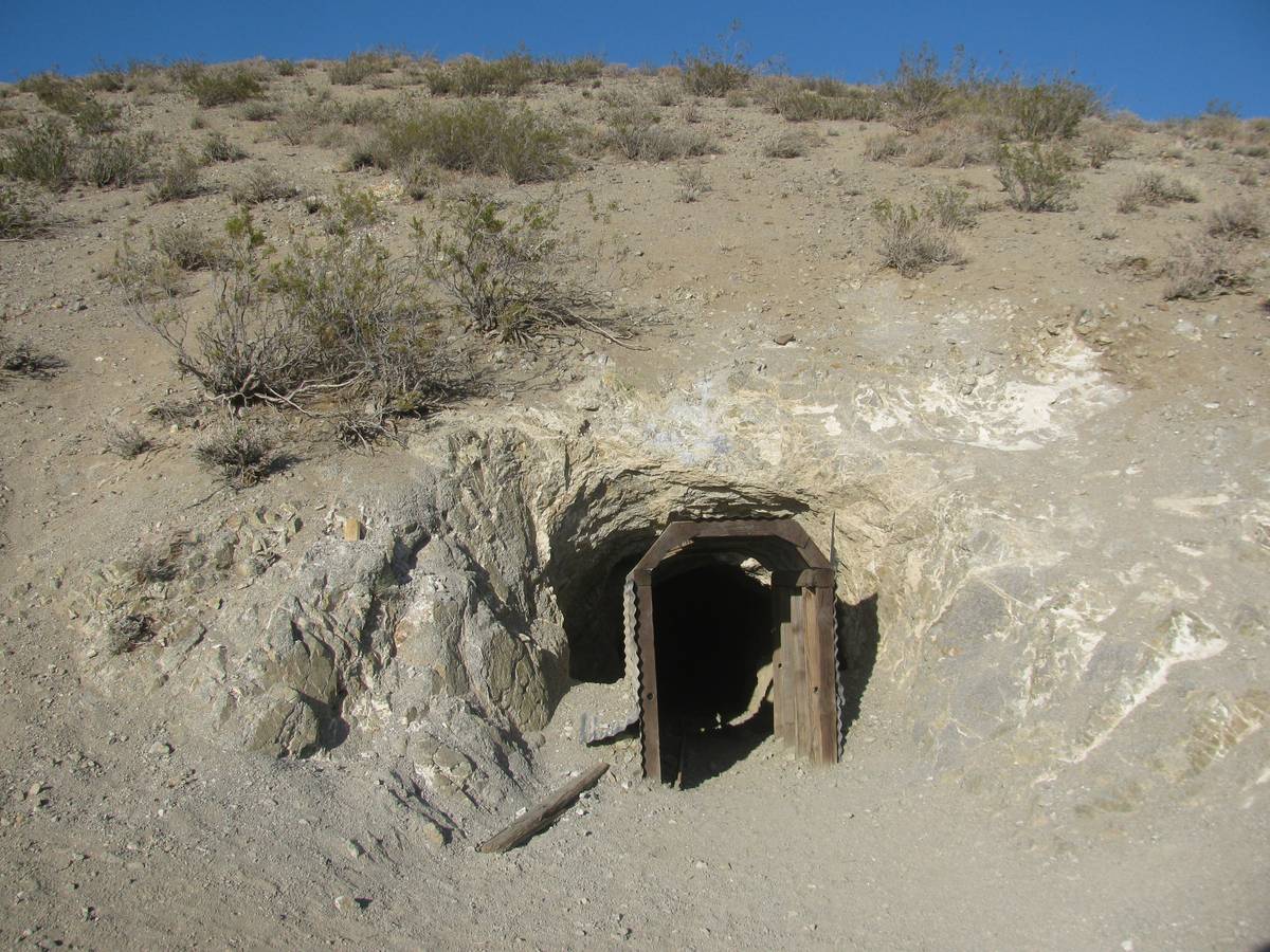

Getting there. Friends of Jawbone locates the tunnel seven miles east of Highway 14 by route EP15.11 Visit California’s directions leave Highway 14 for Redrock-Randsburg Road, then take Mesquite Canyon Road, a dirt road it says is best driven in a high-clearance four-wheel drive, then EP15 for 2.7 miles and a half-mile spur to the site.12 Do not attempt it in a low car, and check the route’s status with BLM first.
Bickel Camp
Friends of Jawbone describes Bickel Camp as a Depression-era mining camp founded by Walt Bickel in 1934, where he mined placer gold with tools and methods of his own, and says it has since been turned into a museum site with much of his equipment still in place.15 We could not confirm from an official source who looks after it now or when it can be visited, so treat it as a place to find out about locally before you go.
What to know before you go
- Carry at least a gallon of water per person per day: many areas here have little or no dependable natural water.16
- Check road conditions and beware of flash floods; if you are stranded, stay with your vehicle.16
- Fire restrictions apply on BLM land for much of the year, and a free California Campfire Permit is needed for a campfire or stove.17
- BLM’s Ridgecrest Field Office, (760) 384-5400, is the authority on what is open.7
Sources
Every fee, rule, distance and date above traces to one of these, checked on the review date. Rules, closures and fees change: where it matters, confirm with the managing agency before you go. If something here is wrong, tell us and it will be fixed.
- 1.El Paso Mountains Wilderness. Bureau of Land Management.
- 2.El Paso Mountains Wilderness. Wilderness Connect, University of Montana.
- 3.S. 21 (103rd): California Desert Protection Act of 1994, text as passed by Congress. GovTrack.us.
- 4.El Paso Mountains. Wikipedia.
- 5.Last Chance Canyon. Wikipedia.
- 6.Geological Gems of California State Parks, GeoGem Note 38: Red Rock Canyon State Park. California Geological Survey, for California State Parks, 2010, published 2015.
- 7.Ridgecrest Field Office. Bureau of Land Management.The office's address and phone, the areas it manages, and the Jawbone Canyon visitor center's address, hours and phone.
- 8.Vehicle Travel. Friends of Jawbone.
- 9.West Mojave Plan route network. Bureau of Land Management.BLM's notice of the court-ordered closure of routes in desert tortoise critical habitat to OHV recreation from 24 March 2026, the areas that remain open, and the Rand Mountains permit.
- 10.Federal Court Orders OHV Route Closures in Mojave Desert. Friends of Jawbone, 4 February 2026.
- 11.Burro Schmidt's Tunnel. Friends of Jawbone.
- 12.Burro Schmidt Tunnel. Visit California.
- 13.Burro Schmidt's Tunnel. California Office of Historic Preservation.
- 14.Burro Schmidt Tunnel. Wikipedia.
- 15.Bickel Camp. Friends of Jawbone.
- 16.Safety. Friends of Jawbone.
- 17.California fire information and restrictions. Bureau of Land Management.Current restrictions by field office, including Stage I rules for Ridgecrest and the free California Campfire Permit.