Nearby · State park · Kern County
Red Rock Canyon State Park, California
The banded red and white cliffs on Highway 14, north of California City. Not the Red Rock Canyon outside Las Vegas: this is a California state park, with a first-come campground, a handful of short trails and one of the most important fossil sites in North America.
Last reviewed · 21 sources
At a glance
- Managed by
- California State Parks, Great Basin District10
- Where
- On Highway 14, 25 miles northeast of Mojave; turn west onto Abbott Drive for the visitor center and campground1
- From California City
- About 20 miles by road, 35 minutes20
- Hours
- Day use sunrise to sunset; the campground is open 24 hours1
- Camping
- Ricardo Campground only: 50 first-come sites, $25 a night1
- Dogs
- Picnic area, campground and dirt roads only; not on trails1
- Phone
- Visitor center (442) 247-5160; Mojave Sector office (661) 946-60921
Is this the Red Rock Canyon near Las Vegas?
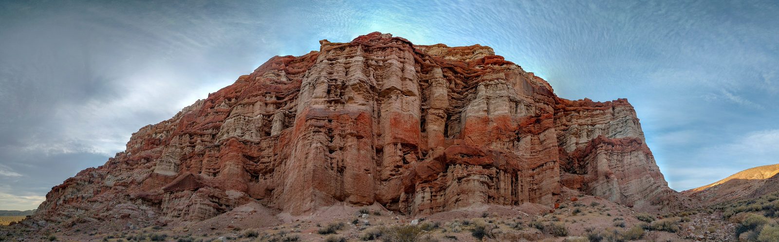

Two well-known places share the name, in two different states. Red Rock Canyon National Conservation Area is in Nevada, 17 miles west of the Las Vegas Strip, and is run by the federal Bureau of Land Management.2 It was designated in 1990, the first national conservation area in Nevada.3
Red Rock Canyon State Park, this page, is in eastern Kern County, California, on State Route 14 between Mojave and Ridgecrest. It is run by California State Parks.1 If a booking site, a map app or a photo caption puts it near Las Vegas, it means the other one. By road the state park is about 249 miles from Las Vegas City Hall.21
Where is Red Rock Canyon State Park, and how do you get there?
The park straddles Highway 14. State Parks gives it as 25 miles northeast of Mojave, near Cantil, and 120 miles north of Los Angeles by Interstate 5 and Highway 14; the turn onto Abbott Drive is signed from the highway, and the visitor center and campground are a quarter of a mile west of it.1 The park’s own 2014 map puts Mojave at 20 miles instead.9 Its planning documents put California City about 17 miles to the southeast, without saying whether that is by road.5 By road from California City’s City Hall to the visitor center it is about 20 miles, or 35 minutes.20 The park is in Kern County.5
Abbott Drive is paved as far as the campground and visitor center. The day-use parking at Hagen Canyon, Red Cliffs, Nightmare Gulch and the smaller stops along the highway is unpaved.5 West of the highway is the original park; the canyons east of it, out to Last Chance Canyon, came later.5
How the cliffs formed, and the fossils in them
The park sits where the southern tip of the Sierra Nevada meets the El Paso Range.1 The Garlock Fault, which separates the Mojave Desert from the Basin and Range, runs just south of it, and a branch of it, the El Paso Fault, runs northeast through the park.11 The cliffs are layers of lake silts, sandstone, gravel, lava and volcanic ash. The reds and pinks come from iron-bearing minerals that oxidised; the white bands are mostly ash.11 The fluted shapes are erosion: wind and rain wearing away softer material beneath harder caprock laid down by lava flows.8
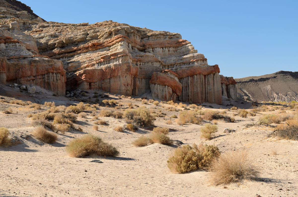

The scientific importance is in the fossils. The Dove Spring Formation, part of the park’s Ricardo Group of rocks, holds the remains of more than a hundred kinds of extinct plants and animals, among them three-toed horses, camels, elephants, rhinoceroses and sabre-toothed cats.11 The University of California Museum of Paleontology describes the park’s record of vertebrates of Clarendonian age as the most complete in North America, and the park as one of the continent’s most important late Miocene fossil sites.12 Collecting anything in the park, fossils, rocks and plants included, is prohibited without a State Parks permit.112
History: people, freight, gold and film
The canyon is in the homeland of the Kawaiisu people, who left petroglyphs in the El Paso Mountains, and it lay on a Native American trade route for thousands of years.1 The earliest archaeological finds in the park are spear points between 8,000 and 10,000 years old.5
State Parks says survivors of the famous Death Valley trek passed through about 1850, and that in the early 1870s the rock formations were landmarks for twenty-mule-team freight wagons that stopped for water.1 A stage station followed, and a post office ran from 1899 to 1916.13 Gold brought hundreds of prospectors in 1893,8 and a short-lived railroad ran through the canyon from 1908 to 1910 to serve construction of the first Los Angeles Aqueduct.13 Rudolf Hagen, a German immigrant who arrived in 1896, acquired mining claims and a homestead and controlled much of the area until his death in 1937.13 Hagen Canyon is named after him.19
From 1920 to 1968 the land was privately owned and heavily used by film crews: the park’s trail guide counts more than 130 films, its planning documents “more than one hundred”.135 The official list of examples runs from The Ten Commandments (1923) and The Mummy through Westworld (1973) and Jurassic Park (1993) to Ghostbusters: Afterlife (2021).5
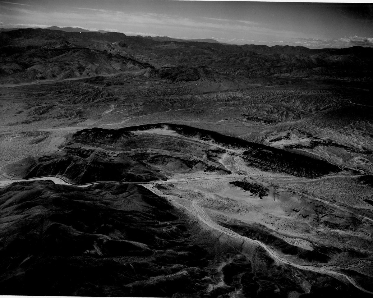

The state bought about 4,000 acres in 1968. The unit was classified a state recreation area in 1973 and reclassified as a state park on 8 February 1980. In 1994 the California Desert Protection Act transferred the federal land around Last Chance Canyon to State Parks.4 The park’s own brochure dates it as a state park from 1968.8 Its size is given as about 25,000 acres in the 2023 planning documents and about 27,000 on the general-plan page.46 A new general plan for the park was adopted in March 2023.7
What facilities does the park have?
The visitor center is at the entrance to Ricardo Campground on Abbott Drive, with exhibits on the park’s natural and cultural history, a media room and a bookstore.5 State Parks currently lists it as open Fridays from 9am to 3pm and weekends from 9am to 5pm.1 Earlier State Parks documents describe it as open at weekends in spring and autumn only, so ring (442) 247-5160 before planning a day around it.58
Shaded picnic tables in the day-use area by the visitor center are first come, first served; the day-use fee is $6 a vehicle, and overnight parking in the day-use lot is not allowed.1 There are pit toilets at the visitor center and at the Red Cliffs day-use area.5 Guided hikes and campfire programmes run in the autumn and spring.1
Camping is at Ricardo Campground only, and there is no reservation system: see camping at Red Rock Canyon State Park. The short trails, with their lengths and closures, are covered in Red Rock Canyon hiking trails.
Can you drive or ride an OHV in the park?
Red Rock Canyon is a state park, not an off-highway riding area. Around 68 miles of primitive roads reach its canyons and viewpoints,5 and vehicles must stay on the open routes. The park’s page says licensed drivers of street-legal vehicles and of green-sticker off-highway vehicles may use that dirt road system, asks drivers to watch for closed-route signs, and applies drink-driving law on the dirt roads as on the highway.1
Some routes are closed to vehicles outright. Orders dated 16 January 2024 permanently closed Ruins Ridge Route, part of Steep Trail and the Steep Trail complex.117 Nightmare Gulch is closed to vehicles until further notice,15 a closure that began in October 2013 after a summer storm washed out sections of the route.16 The park’s 2014 map still draws Nightmare Gulch as a four-wheel-drive route.9 Bicycles must stay on roads.1
Park rules: dogs, drones, fires and collecting
- Dogs are allowed in the picnic area, the campground and on the dirt roads, on a leash no longer than six feet, and not on trails; trained service animals are the exception.1
- Drones are prohibited over the park by posted order, including for personal filming.1
- Fires only in the metal fire rings in the campground; no rock rings anywhere.1
- Firearms, shooting and hunting are not permitted.1
- Collecting of plants, animals, fossils, rocks or cultural objects is prohibited without a permit.1
- Nightmare Gulch is closed to all entry from February to June to protect nesting birds of prey.1
- Filming and photography for commercial, student, nonprofit, news or documentary work needs a permit arranged at least ten days ahead.1
When is the best time to visit?
Spring and autumn. State Parks says visitation rises from mid-October and usually lasts into mid-May.5 The park’s own weather station, averaged over 1971–1992, recorded July highs around 102°F and January lows around 29°F, with about six and a half inches of rain a year.5 Winds above 25 mph are common, with gusts reported to 75 mph.5
Summer thunderstorms can bring flash floods. In September 1997 an estimated 10 to 15 inches of rain fell in two hours at the visitor center, destroying park buildings and parts of Highway 14.5 Check the current-restrictions panel on the park’s page after any storm.1 After a wet winter the wildflowers can be exceptional.1
The nearest live forecast on this site is for California City, about 20 miles away by road: see California City weather and desert conditions.
Common questions about Red Rock Canyon State Park
What county is Red Rock Canyon State Park in?
Kern County, California.5 The park is on Highway 14, 25 miles northeast of Mojave.1
How far is Red Rock Canyon State Park from California City and Los Angeles?
About 20 miles by road from California City's City Hall to the visitor center, around 35 minutes.20 State Parks puts the park 120 miles north of Los Angeles, by Interstate 5 and Highway 14.1
How far is it from Las Vegas?
About 249 miles by road from Las Vegas City Hall, or four hours and 40 minutes without traffic.21 The Red Rock Canyon 17 miles west of the Las Vegas Strip is a different place: a national conservation area in Nevada.2
Is Red Rock Canyon State Park free?
No. Day use is $6 per vehicle, or $5 for seniors, and a campsite is $25 a night.1
Are dogs allowed at Red Rock Canyon State Park?
Only in the picnic area, the campground and on the dirt roads, on a leash no longer than six feet. Dogs are not allowed on the trails; trained service animals are the exception.1
When is the park open?
Day use is from sunrise to sunset, and the campground is open 24 hours. State Parks lists the visitor center as open on Fridays from 9am to 3pm and at weekends from 9am to 5pm.1 Storms close roads and trails, so check the current restrictions on the park's page before you drive out.1
Sources
Every fee, rule, distance and date above traces to one of these, checked on the review date. Rules, closures and fees change: where it matters, confirm with the managing agency before you go. If something here is wrong, tell us and it will be fixed.
- 1.Red Rock Canyon State Park. California State Parks.The park's official page: directions, hours, fees, camping, dogs, vehicles, drones, closures and contacts. Its current-restrictions panel was empty when checked.
- 2.Red Rock Canyon National Conservation Area. Bureau of Land Management.The Nevada Red Rock Canyon, for disambiguation.
- 3.Red Rock Canyon National Conservation Area. Bureau of Land Management, National Conservation Lands.
- 4.Staff report: Red Rock Canyon State Park General Plan Revision. California State Park and Recreation Commission, 3 March 2023.The park's classification history, the 1994 transfer, and the vehicle-use direction of the plan adopted in 2023.
- 5.Red Rock Canyon State Park Preliminary General Plan Revision and Draft EIR. California State Parks, via CEQAnet, October 2022.The most detailed official description of the park's roads, trails, facilities, climate and history. A preliminary document: the adopted plan corrected some acreage and history figures.
- 6.Red Rock Canyon State Park General Plan Revision. California State Parks.
- 7.Addendum to the Red Rock Canyon State Park General Plan and Environmental Impact Report. California Department of Parks and Recreation, via CEQAnet, received 27 March 2023.Records the adopted general plan and its notice of determination, signed 6 March 2023.
- 8.Red Rock Canyon State Park brochure. California State Parks, revised 2014.
- 9.Red Rock Canyon State Park map. California State Parks, 2014.Predates the 2024 vehicle closures; its road information is out of date for Nightmare Gulch.
- 10.Great Basin District. California State Parks.
- 11.Geological Gems of California State Parks, GeoGem Note 38: Red Rock Canyon State Park. California Geological Survey, for California State Parks, 2010, published 2015.
- 12.Red Rock Canyon State Park, California (Fossils in our parklands). University of California Museum of Paleontology.
- 13.Nature trail tour guides. California State Parks.
- 14.California State Parks day use and entry fees. California State Parks.
- 15.Superintendent's Order 577-24-003: Nightmare Gulch. California State Parks, Great Basin District, 16 January 2024.
- 16.Nightmare Gulch Project. California State Parks.
- 17.Superintendent's order locations, Red Rock Canyon State Park. California State Parks, January 2024.With the orders closing Ruins Ridge Route, part of Steep Trail and the Steep Trail complex to vehicles.
- 18.Expect a limited wildflower bloom this spring in Southern California's state parks. California State Parks, 24 February 2025.Includes the department's safety advice for desert parks: cell coverage, GPS routing onto four-wheel-drive roads, food, fuel and water.
- 19.Hiking. Red Rock Canyon Interpretive Association.Undated.
- 20.Route from California City City Hall to the Red Rock Canyon visitor center. OSRM routing on OpenStreetMap data, routed 17 September 2026.19.6 miles; about 35 minutes in free-flowing traffic.
- 21.Route from Las Vegas City Hall to the Red Rock Canyon State Park visitor center. OSRM routing on OpenStreetMap data, routed 24 September 2026.248.5 miles; about 4 hours 41 minutes in free-flowing traffic.